Collaborative Geodesign
People, Environment, and Tools
Peter Wiringa, University of Minnesota
wiringa@umn.edu
Some context
Project: New Agricultural Bioeconomy
“…[provides] state-of-the-art technology for exploring new opportunities to enhance economy, environment, and community vitality in agricultural regions of Minnesota.”
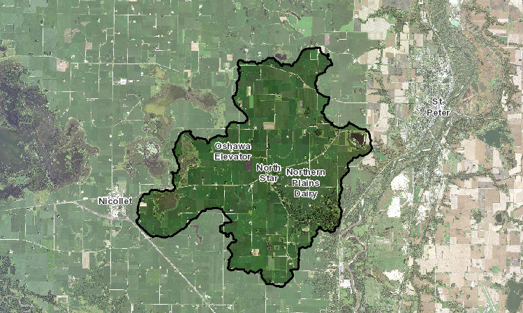
AOI: Seven Mile Creek
24,000 acres of fun!
Definitions
Geodesign
“Geodesign is a design and planning method which tightly couples the creation of design proposals with impact simulations informed by geographic contexts.”
Collaborative geodesign
“…[a] framework for design projects which required iteration, feedback, and collaboration”
Three core areas
- People
- Environment
- Tool(s)
1. People
Put people first
- Stakeholder engagement
- Build community
- Build trust
- Work together
People need tasks and goals
There's a reason you need a collaborative geodesign tool, and a reason your stakeholders should be using it. Don't put something in front of them without a clear task or goals, grounded in the real world.
Why belabor this?
Every project is different.
Every team is different.
Do what you need to do.
2. Environment
Plan Ahead
Cramped quarters? Wide open spaces? As with any event, get familiar with the space(s) you'll have to work in ahead of time, if possible.
Comfort zones
- People may not know each other,
- they may not even like each other,
- but they need to be able to collaborate.
What medium?
Or, media?
- Pencil & paper
- Whiteboard
- Tablet
- Large touchscreen
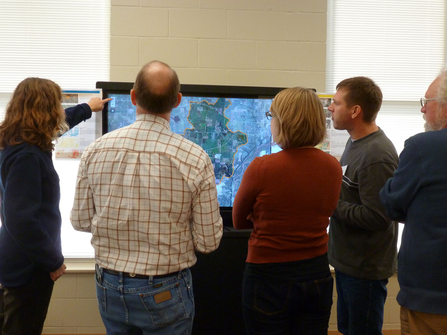
Our choice
- 55" touchscreens
- Rolling cases
- Windows 8.1 (not by choice?)
- Chrome
3. Tools
The right tool(s)…
- …support the people (and their task)
- …work in the environment
- …allow for iteration, feedback, and collaboration
Support the people
- Usable tools
- Accessible tools
- Tools that support “mistakes”
- Anticipate (or observe) needs
- Tools that provide valuable reference data (layers)
- Scenarios that they can understand and run with
Work in the environment
- Where are you taking the tool?
- Can you even get the tool in the door?
- Power?
- Network?
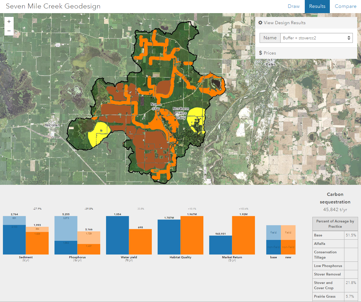
Iteration
- Results…just like that!
- Refine the previous design
- Load older designs
Feedback
- Design results
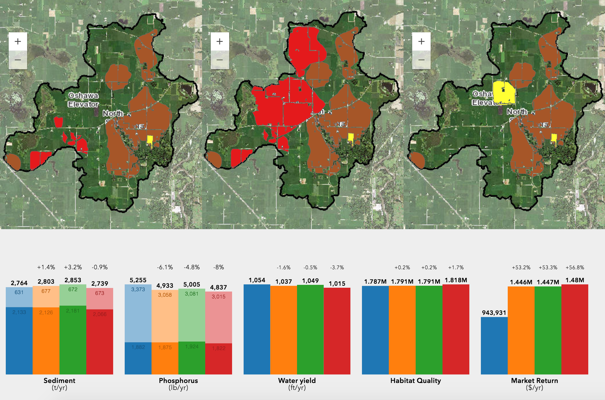
- Comparative results
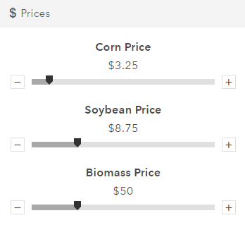
- Not fixed in time (e.g., price)
Collaboration
- You laid the groundwork, right?
- Keep it simple, but expose a lot
- Groups should be able to mediate themselves
- Keep someone from your team available to assist
- Consider having someone softly shadow each group
Support by testing and observing
- There's no substitute for actual users
- They need to iterate, so do you
- Observe, adjust, repeat
- Interrogate their needs
- Be gentle
Bonus ideas
- Timestamp everything
- Allow playbacks
Time's up
Thanks for coming. Any questions?
Slides: z.umn.edu/collabgeodesign